New Zealand's map & navigation store
since 1997
home
contacts
how to order
staff
store
terms & conditions
maps
africa
antarctica
asia
australia
canada
central america
europe
himalaya region
middle east
new zealand
- city maps
- digital mapping
- newtopo maps
- recreation maps
- rural road maps
- scratch maps
- topographic maps
- tramping maps
- travel maps
pacific islands
- roads
- topos
south america
uk
usa
wall maps
australia
international
mural
new zealand
- north island
- south island
scratch maps
unusual
world
books
armchair travel
mapaholics
quirky
world atlases
children
books
games
globes
maps
placemats
equipment
beacons
compasses
magnifiers
accessories for maps
map holders
trackers
travel accessories
flags
new zealand
world
garmin GPS
auto
communication
cycle
fitness
handheld
mapping for garmin
marine handheld
military
motorbike
tracking
wearable
globes
children's
desk
educational
globes under $100
globes under $300
floor
illuminated desk
mini
national geographic
novelty
replogle
new zealand
accessories for maps
alpine guide books
atlases
bathymetry lakes
bathymetry sea
bird watching
cycling
fauna & flora
geology maps & books
guide books
historical maps
nautical charts
spot x books
tramping books
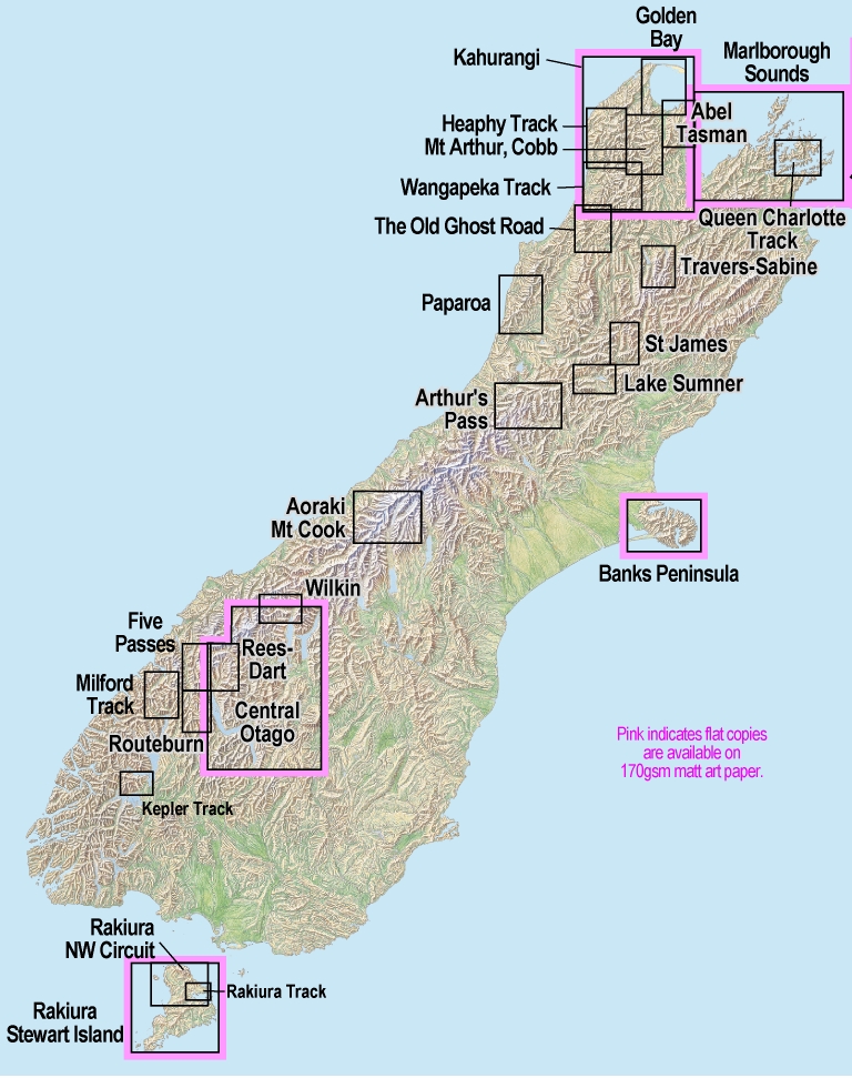
NewTopo - South Island Maps
NewTopo maps are designed to encourage walking in New Zealand's most popular regions and tracks
Scale
Map scales vary to suit the region or track. The maps are either small format: 297x420mm (A3), or large format: 840x600mm.
The maps in the list below are arranged
geographically
from north to south.
Click on the map title below for
more information
and an image of the coverage.
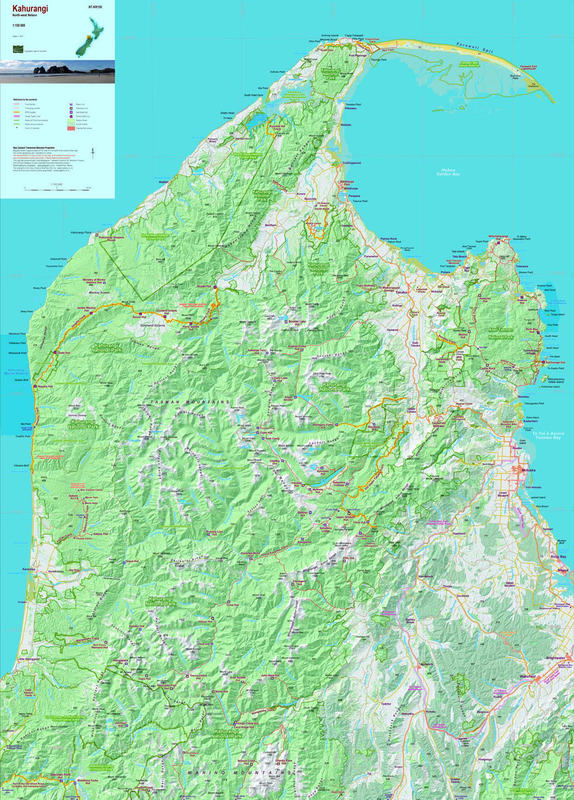
Kahurangi
Kahurangi Poster (flat)
Heaphy Track
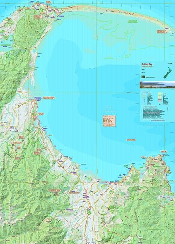
Golden Bay
Abel Tasman Coastal Track
Nelson / Marlborough Sounds
Nelson / Marlborough Sounds Poster (flat)
Queen Charlotte Track
Mt Arthur, Cobb
Wangapeka Track
Old Ghost Road
Paparoa Track
Nelson Lakes/Travers-Sabine Circuit
St James Walkway
Lake Sumner Tramps
Arthur's Pass
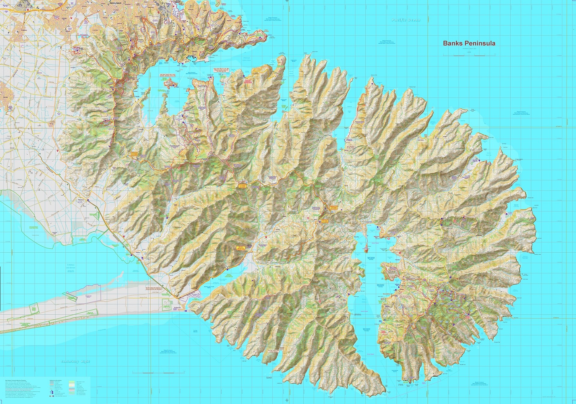
Banks Peninsula
Banks Peninsula Poster (flat)
Banks Peninsula Small Poster (flat)
Aoraki Mt Cook
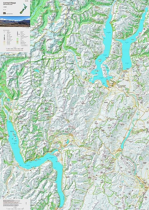
Central Otago
Central Otago Poster (flat)
Wilkin Valley / Mt Aspiring National Park
Rees-Dart Track
Five Passes Wilderness
Routeburn, Greenstone, Caples Track . . .
Milford Track
Kepler Track
Hump Ridge Track
Rakiura Track, Stewart Island
Rakiura Track, Northwest and Southern Circuit
Rakiura, Stewart Island
Rakiura, Stewart Island (flat)
South Island Wall Maps
NewTopo
North Island maps
home
contacts
links
how to order
store
All prices are in NZ$ including GST.
MapWorld is not liable for any inaccuracies in this information.
© MapWorld New Zealand, 2023