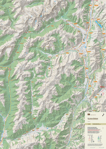
St James Walkway
- Scale: 1:40,000
- Size: 600x 840 mm
- Folded: $26.90
ĀThe road over the Lewis Pass isĀ on the western edge of the map.Ā Part of the St James Cycle Trail is along the eastern edge.Ā The combination of contours andĀrelief shading, gives a realistic landform.
The map covers a large part of the St James Conservation Area.Ā The Te Araroa Trail passes diagonally across the map.Ā Most of the Lewis Pass National Reserve is on the western edge.