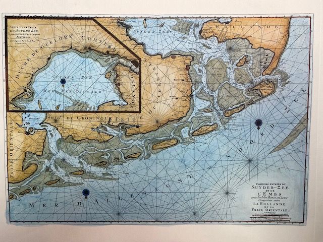
Zuiderzee and Ems Entrances, Holland and Eastern Frisia - Nautical Chart, 1693
$56.52
In stock: 1 available
Product details
42cm x 34cm modern print, printed on thick heavyweight matte paper. Originally purchased in Germany 1975.
The "Carte des Entrées du Suyder Zee et de l'Embs" (often transcribed as Syder-Zee or Zuiderzee, and Embs for the Ems River) is a famous historical maritime chart dating back to 1693.
This sea chart was published in Amsterdam by the prominent cartographer and publisher Pierre Mortier. It is part of the prestigious maritime atlas titled Le Neptune François (or Atlas Nouveau des Cartes Marines), which was produced at the end of the 17th century for naval and navigational use.
What Does the Chart Represent?
The original copper-engraved map (measuring approximately 61 x 89 cm) provides a highly detailed view of the strategic shipping lanes between the modern-day Netherlands and Germany:
- The Entrances to the Zuiderzee: The former shallow bay in the central Netherlands (which has since been closed off by the Afsluitdijk dike and partially reclaimed).
- The Mouth of the Ems River (l'Embs): The European river that flows into the North Sea at the Dollart bay, marking the border between Dutch Friesland and German East Friesland.
- Coastal Navigation Details: It maps out depth soundings, dangerous sandbanks, the Frisian Islands, coastal villages, lighthouses, and even prominent windmills used as landmarks by sailors.
Zuiderzee and Ems Entrances, Holland and Eastern Frisia - Nautical Chart, 1693
Display prices in:NZD
