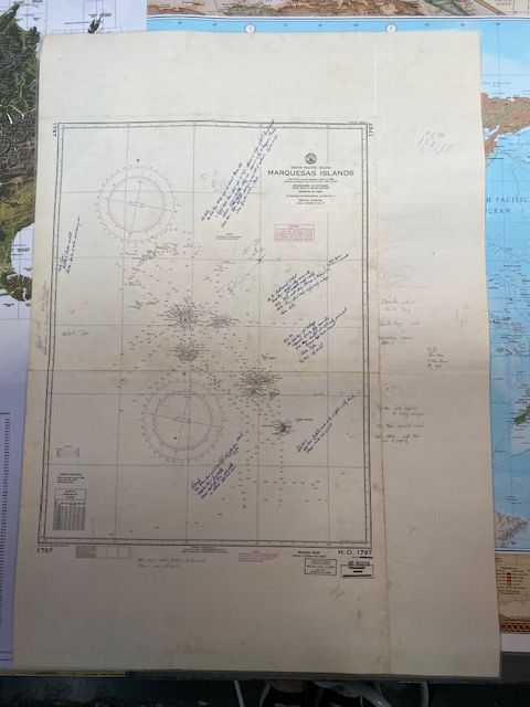
Vintage Sea Chart of the Marquesas Island 7th Edition 1920 (revised 1968)
$150
Price incl. GST (15%) $19.57
In stock: 1 available
Product details
The 1968 revision marks a highly specific operational shift for Chart No. 1797.
By the mid-1960s, the U.S. Navy Hydrographic Office (H.O.) had been reorganized into the Naval Oceanographic Office (NAVOCEANO). The 1968 printing/revision of Chart 1797 represented one of the final standardized military layout revisions for this sheet before international charting responsibilities over French Polynesia transitioned more heavily to satellite and modern computerized systems.
Features of the 1968 Revision:
-
Agency Stamp:
Rather than the older "Hydrographic Office" header from the 1920 era, this print carries the Naval Oceanographic Office designation. -
Navigational Updates:
The 1968 revision integrated standard post-WWII soundings, adjusted the grids for updated World Geodetic System (WGS) calculations, and completely overhauled the magnetic variation compass roses to reflect the earth's shifting magnetic fields up to 1968. -
Cold War Context:
Charting of the South Pacific in 1968 was closely monitored due to regional changes, including the establishment of French nuclear testing facilities in the broader Tuamotu/Polynesia region (which began in 1966), making up-to-date regional naval charts vital for U.S. Pacific Fleet awareness.
Condition:
- Map size: 77cm x 107cm
- Notations: Map includes pen and pencil notations and observations from a 1970's voyage from San Francisco to New Zealand.
- Preservation: Visible fold line and some marks and stains. The map has been laminated to preserve its condition.
Vintage Sea Chart of the Marquesas Island 7th Edition 1920 (revised 1968)
Display prices in:NZD
