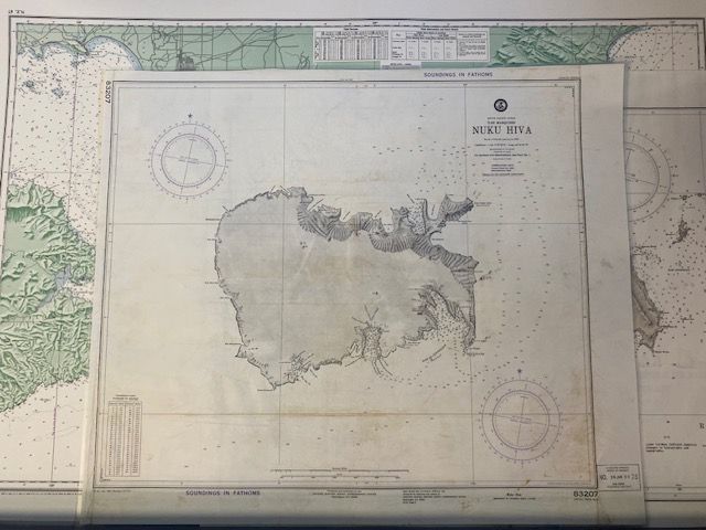
Vintage Sea Chart Of the Iles Marquises NUKU HIVA 1947
$100
Price incl. GST (15%) $13.04
In stock: 1 available
Product details
Vintage Sea Chart of the Iles Marquises NUKU HIVA (1947)
Explore the 7th Edition of Chart 83207, a remarkable historical nautical chart originally published in 1947 by the U.S. Hydrographic Office. This edition offers a fascinating glimpse into the post-World War II maritime mapping era, with significant details that continue to captivate mariners and history enthusiasts alike.
Key Features of the 1947 Edition
-
Historical Significance:
- This chart was part of the U.S. Hydrographic Office's post-WWII efforts to update South Pacific maritime maps, incorporating data from both captured records and Allied survey information.
-
French Survey Legacy:
- The chart's foundation is based on a French survey conducted in 1881, showcasing the enduring value of 19th-century hydrographic expeditions.
-
Detailed Coverage:
- Includes precise soundings, hazard markings, and approach guidelines for navigating Nuku Hiva's key harbors:
- Taiohae Bay (South Coast)
- Anaho Bay (North Coast)
- Includes precise soundings, hazard markings, and approach guidelines for navigating Nuku Hiva's key harbors:
This chart not only serves as a practical tool for navigation but also as a historical artifact, reflecting the intricate and collaborative efforts of maritime cartography in the mid-20th century.
Condition
- Map dimensions: 73cm x 62cm
- Some visible creases, staining, and marks.
- Pencil mark additions visible.
- This copy has been laminated to preserve its condition.
Vintage Sea Chart Of the Iles Marquises NUKU HIVA 1947
Display prices in:NZD
