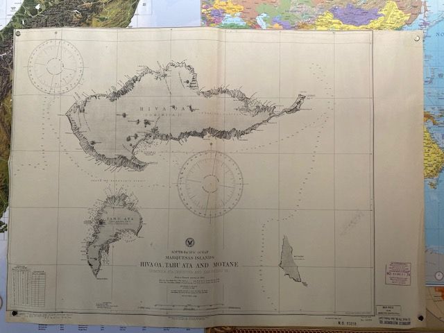
Vintage 1945 Seachart Marquesas Islands
$60
Price incl. GST (15%) $7.83
In stock: 1 available
Product details
The Sea Chart No. 1599 is a historic nautical chart that highlights a portion of the Marquesas Islands in the South Pacific Ocean. This chart specifically focuses on the islands of Hiva Oa, Tahu Ata, and Motane.
Chart Specifications & Archive
-
Historical Origins:
The chart was primarily based on a French hydrographic survey conducted in 1882. -
The 1917 Edition:
The 4th Edition of the chart was published on 1 September 1917. During this period, versions of the chart series were maintained and distributed by both the British Admiralty and the United States Hydrographic Office. -
The 1945 Reprint:
The 1945 reprint of British Admiralty Chart 1599 retains the 4th Edition (1917) base map layout. However, it includes critical, cumulative hydrographic corrections that were added during and immediately following World War II.
Document Details
-
Title Designation:
South Pacific Ocean: Marquesas Islands. -
Survey Core:
The chart is predominantly based on the 1875 operations of Captain G. Pierre of the French Navy aboard L'Infernet, with additional revisions by the British and French Admiralty leading into the mid-20th century. -
Physical Format:
Engraved and printed as a single large sheet measuring approximately 66 x 83 cm (on a 72 x 104 cm paper stock). -
Historical Context:
The 1945 reprints played a crucial role in military logistics and Allied naval routing through French Polynesia during the closing stages of the Pacific War.
Condition
The map shows a visible center fold line and some minor marks. Additionally, correction and shop stamps can be observed on the outer border.
Vintage 1945 Seachart Marquesas Islands
Display prices in:NZD
