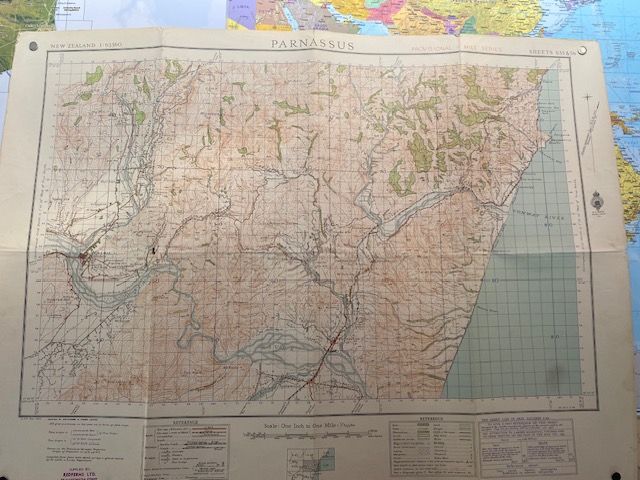
Vintage 1943 North Canterbury Topographical Map
$50
Price incl. GST (15%) $6.52
In stock: 1 available
Product details
Product Description
Key Features:
- Linen-backed paper map measuring 80cm x 60cm.
- Visible fold lines and a small hole in the mapped area.
Historical Significance:
- This 1943 vintage topographic map of Parnassus is part of the NZMS 1 (New Zealand Map Series 1) topographic map series, specifically Sheet S55 & S56.
- Produced during World War II, it captures critical wartime geographical data compiled by N.Z. Aerial Mapping Ltd.
Scale and Details:
- Scale: 1 inch to 1 mile (1:63,360).
- Covers the North Canterbury locality, including:
- Historical roads.
- Railway lines.
- Regional rivers.
This map is a unique piece of history, offering a glimpse into the geographical landscape of North Canterbury during a pivotal time in world history.
Vintage 1943 North Canterbury Topographical Map
Display prices in:NZD
