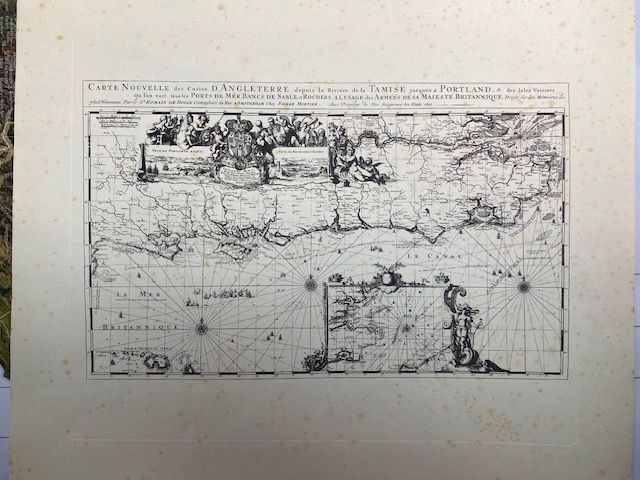
Thames River to Portland, England - Nautical Chart, 1693 - Historical Map Print
$43.48
In stock: 1 available
Product details
42cm x 34 cm copy - Printed on thick heavyweight matte paper. This copy purchased in Germany 1975 - has foxing over map and border.
The "Carte Nouvelle des Costes d'Angleterre" (New Map of the Coasts of England) is a famous historical maritime chart engraved by the celebrated Dutch artist and cartographer Romeyn de Hooghe and published in Amsterdam by Pierre Mortier in 1693. It was featured in the prestigious maritime atlas, Le Neptune François.
Key Features of the Map:
- Geographical Coverage: The full title translates to "New Map of the Coasts of England from the River Thames to Portland". It covers the southern coast of England, focusing on the Thames Estuary, the Isle of Wight, and the crucial naval port of Portsmouth.
- Artistic Style: Romeyn de Hooghe was renowned for his spectacular Baroque style. The map stands out for its sumptuous illustrations, featuring detailed warships, elaborate compass roses, and allegorical cartouches decorated with mythological figures and royal coats of arms.
- Functionality: Despite its high artistic value, it served as a functional sea chart. It detailed sandbanks, coastal ports, depth soundings, and rhumb lines for contemporary maritime navigation.
Thames River to Portland, England - Nautical Chart, 1693 - Historical Map Print
Display prices in:NZD
