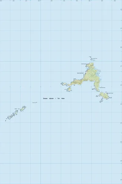
SI01 Snares Islands/Tini Heke
$8
Price incl. GST (15%) $1.04
Size
Please choose
In stock: 2 available
Product details
The Snares Islands/Tini Heke is an uninhabited, heavily protected subantarctic island group located about 100 to 200 km southwest of Stewart Island / Rakiura, New Zealand.
Key Geography & Details
-
Location & Area: Situated at approximately 48°02′S, 166°33′E with a total land area of about 3.4 km² (340 hectares), comprising North East Island, Broughton Island, Alert Stack, Daption Rocks, Vancouver Rock, and the Western Chain (Tahi, Rua, Toru, Wha, Rima).
-
Topography: Low-lying compared to other subantarctic islands, reaching a maximum elevation of 130 meters on North East Island.
-
Designation & Status: A designated nature reserve managed with minimum impact—landing is strictly by permit only, though commercial expedition zodiac cruises offer close-up views offshore.
-
Topographic Mapping: Covered by Land Information New Zealand (LINZ) map sheet SI01, Snares Islands, Edition 2.00.
Flora and Fauna
-
Vegetation: Roughly 80% covered in dense Olearia lyallii tree daisy forests, along with megaherbs like Stilbocarpa robusta.
-
Endemic Birds: Home to millions of seabirds, including the endemic Snares Crested Penguin (around 30,000 breeding pairs), plus the Snares Island fernbird, Snares Island tomtit, and Snares Island snipe.
-
Marine Life: Breeding colonies of New Zealand fur seals and resting New Zealand sea lions along the rocky coastlines
SI01 Snares Islands/Tini Heke
Display prices in:NZD