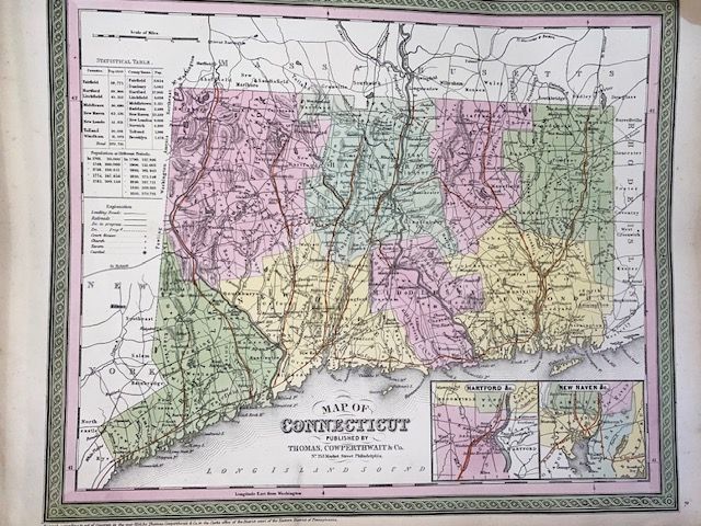
Rare Original 1854 Mitchell Map of Connecticut
$350
Price incl. GST (15%) $45.65
In stock: 1 available
Product details
The 1854 Mitchell Map of Connecticut is a highly sought-after, authentic mid-19th-century map created by the renowned American cartographer Samuel Augustus Mitchell. Originally engraved and prepared as Plate No. 9 for the 1854 edition of Mitchell's New General Atlas, it reflects a pivotal era of industrial and population growth in New England
Key Features & Design Details
-
Cartography & Production: Though published in 1854, the map carries a copyright date of 1850 under the Philadelphia publishing firm Thomas Cowperthwait & Co.
-
Visual Aesthetic: Engraved and hand-colored in Mitchell's unmistakable signature style, it features vibrant pastel tones defining county borders and a distinct, intricate green vine border work surrounding the entire sheet.
-
Geographic Coverage: Centered on Hartford and Middlesex, the layout captures the entire state from Fairfield in the west to Windham and New London in the east.
-
Special Insets & Data: The lower-right corner includes two detailed inset maps of the vicinities of Hartford and New Haven. The upper-left quadrant contains a comprehensive statistical table listing town and county populations across different historical eras.
-
Historical Elements: The map preserves critical 19th-century infrastructure, noting early townships, canals, roads, and rapidly expanding early railroads, with local terrain and elevation beautifully rendered using hachure lines.
Technical Specifications
- Standard Dimensions: The printed area typically measures approximately 13 inches high by 16 inches wide (roughly 33 x 41 cm) with a blank verso (backside).
- Excellent condition
Rare Original 1854 Mitchell Map of Connecticut
Display prices in:NZD