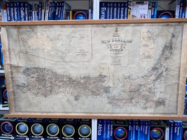
Rare New Zealand Map 1921
$500
Price incl. GST (15%) $65.22
In stock: 1 available
Product Details
Dominion of New Zealand with Mountain Features in Pictorial Relief
Details:
- Publisher: New Zealand Lands and Survey Department, W. Deverell
- Location: New Zealand
- Coordinates: 36°51′S 174°47′E
- Scale: 1:1 584 000
- Year: 1921
Key Features of the Map:
-
Three Maps in One:
- Steamer Routes and Telegraph Cable Connections: A detailed map located at the top left, showcasing New Zealand's steamer routes and telegraph cable connections.
- Enlarged City Map: A closer view of the city of Rotorua is included for enhanced detail.
- Main Map: A comprehensive representation of New Zealand, with a special focus on the detailed depiction of the country's relief features.
-
Pictorial Relief:
The main map highlights the mountainous regions with a unique pictorial style, bringing the highlands to life. -
Important Note:
“The pictorial delineation of the high country in this Map will obviously upset the use of the Scale in ascertaining distances along or within the Mountain ranges.”
This rare map from 1921 beautifully captures the geographic and infrastructural details of New Zealand during that time, making it a valuable piece for collectors and history enthusiasts alike.
- Map dimensions: 107cm x 59cm
- Condition: Linen backed with some cracking and crease marks, but overall in good condition for a 105-year-old map.
Save this product for later
Rare New Zealand Map 1921
Display prices in:NZD
