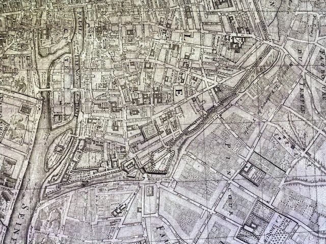
Rare Map Of Paris - circa 1700 - Original
$2,500
Price incl. GST (15%) $326.09
In stock: 1 available
Product details
"Plan of the City, Cité, University, and Suburbs of Paris with its Environs"
- An uncoloured, crisp impression on strong laid paper.
- Full margins present.
- Excellent internal condition with the rare separate typographic index sheet.
- Minor age-toning, with small closed tears and light water staining restricted entirely to the outer margins, well away from the plate mark and text.
Historical Context
This is a famous historical map engraved around 1700. It is primarily associated with the Jaillot family of cartographers (notably Hubert-Alexis Jaillot and his son). The map depicts Paris during the reign of King Louis XIV, divided into its traditional sectors:
- The Cité: The historic island at the heart of the Seine River, home to the Palace of Justice and Notre-Dame.
- The University: The Left Bank (Rive Gauche), traditionally occupied by colleges and educational institutions.
- The City: The Right Bank (Rive Droite), the expanding centre of trade and royal power.
- The Suburbs (Faubourgs): Settled areas located just outside the old fortified city walls.
- The Environs: The open countryside, neighbouring villages, and large wooded estates that surrounded the capital at the time.
Signature of the Engraver
The Latin signature "van Loon Sculp." (short for van Loon sculpsit, meaning "engraved by van Loon") appears at the bottom right corner of this specific 1700 Paris map.
This signature identifies the masterful engraver behind the map's intricate visual details: Harmanus van Loon (also known as Hermanus or Hendrik).
Map dimensions: 60cm x 47cm, with a similarly sized index on a separate sheet.
Rare Map Of Paris - circa 1700 - Original
Display prices in:NZD
