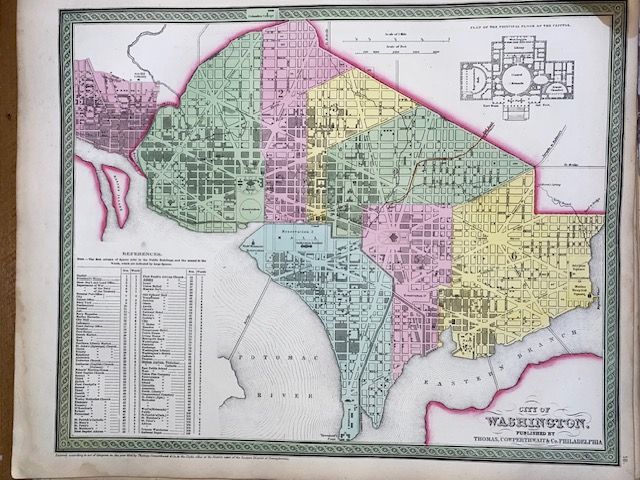
Rare, Antique 1854 Mitchell Map City of Washington
$300
Price incl. GST (15%) $39.13
In stock: 1 available
Product details
The Rare, Antique 1854 Mitchell Map of the City of Washington is a highly collectible mid-19th-century plan of Washington, D.C.. Prepared by prominent American cartographer S. Augustus Mitchell, it was published as Plate 16 in the 1854 edition of Mitchell’s New Universal Atlas (and New General Atlas) by the Philadelphia firm Thomas, Cowperthwait & Co.
Key Identification & Cartographic Details
-
Historical Context: The map contrasts Pierre L'Enfant’s grand projected layout of the capital against the actual, contemporary 1854 reality of Washington D.C., which at the time remained a sparsely developed area punctuated by massive Grecian monuments. [
-
Distinctive Insets: The upper-right corner features a detailed architectural plan of the Principal Floor of the Capitol Building. The lower-left corner includes a comprehensive building and ward index detailing streets, parks, churches, hotels, and railroads.
-
Aesthetic Style: It features Mitchell's iconic engraved hand-coloring dividing the city into distinct pastel-colored wards, wrapped within a decorative green border pattern. [1,
Document Specifications
-
Dimensions: Image sizes generally measure approximately 12.5 x 15.5 inches (32 x 39 cm), with an overall sheet size of roughly 13 x 16 inches.
-
Scale: Rendered at a scale of 1:22,000.
-
Copyright Inscription: Though published in the 1854 atlas, the map face typically carries a copyright line reading: "Entered according to Act of Congress in the year 1850 by Thomas Cowperthwait & Co.
Rare, Antique 1854 Mitchell Map City of Washington
Display prices in:NZD