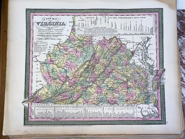
Rare 1854 Mitchell "A New Map of Virginia"
$150
Price incl. GST (15%) $19.57
In stock: 1 available
Product details
The 1854 Mitchell "A New Map of Virginia" is a highly sought-after historic map created by the prominent American cartographer Samuel Augustus Mitchell. Published in Philadelphia as part of his renowned A New Universal Atlas, this specific edition is particularly notable for capturing a critical snapshot of American geography just prior to the Civil War.
Key Features of the 1854 Edition
-
Unified Virginia: The map depicts Virginia and West Virginia as a single, unified territory. This was printed nearly a decade before West Virginia separated and gained statehood in 1863 during the Civil War.
-
Transportation Detailed: True to its full original title ("A New Map of Virginia, with its Canals, Roads and Distances..."), it comprehensively details the state’s early infrastructure, including active stagecoach routes, steamboat lines, and expanding canal systems.
-
Visual Insets: Most printings feature distinct graphic elements, including a detailed Profile of the Chesapeake & Ohio Canal and an inset map of the District of Columbia.
-
Aesthetic Border: It is easily recognizable by Mitchell’s signature elaborate, hand-colored floral or vine-style border, which framed most of his mid-19th-century atlas maps.
Rare 1854 Mitchell "A New Map of Virginia"
Display prices in:NZD