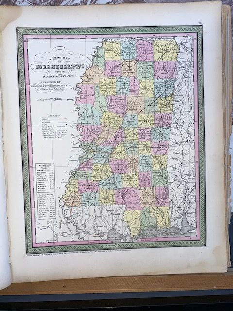
Rare 1854 Mitchell "A New Map of Mississippi"
$150
Price incl. GST (15%) $19.57
In stock: 1 available
Product details
The 1854 Samuel Augustus Mitchell Sr. map titled "A New Map of Mississippi with its Roads & Distances" is a highly collectible and aesthetically definitive example of mid-19th-century American cartography. Originally prepared by Mitchell and published in Philadelphia by Thomas, Cowperthwait & Co., this specific map was issued as Plate 23 in Mitchell's New Universal Atlas.
Key Features & Design
- The "Mitchell Green" Border: Maps from this specific decade are instantly recognizable by Mitchell's iconic, intricate green interlocking scrollwork border. [1, 2]
- Vivid Pastel Color-Coding: The map features original, hand-applied watercolor washes in pink, green, yellow, and blue pastels to distinguish individual counties. [1, 2]
- Transit & Travel Insets: True to its title, the lower-left quadrant includes an invaluable tabular inset detailing steamboat routes and mileage (such as paths from Natchez to New Orleans and Natchez to Pittsburgh) alongside early overland roads and planned railway networks.
- Topography: Elevation and terrain features are beautifully rendered using traditional hachure relief techniques.
Cartographic History & The "Copyright Ambiguity"
If you look closely at the bottom of an authentic 1854 print, you will notice a legal line stating: "Entered according to act of Congress, in the year 1850, by Thomas Cowperthwait & Co...". This leads many collectors to misidentify the map's age.
The 1850 date refers strictly to when the base engraving plate layout was registered with the Clerk's office. The map was actually printed, updated, and distributed inside the 1854 edition of the atlas.
Rare 1854 Mitchell "A New Map of Mississippi"
Display prices in:NZD