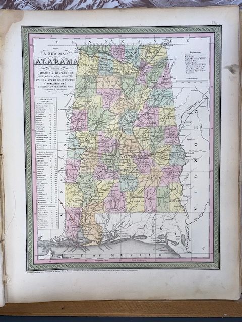
Rare 1854 Mitchell "A New Map of Alabama"
$250
Price incl. GST (15%) $32.61
In stock: 1 available
Product details
The 1854 edition of Samuel Augustus Mitchell’s "A New Map of Alabama" is a highly prized historical artifact of American cartography. Published in Philadelphia during a period of rapid transition for the Mitchell firm, this specific map reflects the booming pre-Civil War expansion of transportation networks across the American South
Historical Context & Rarity
The map originally appeared as a plate within Mitchell’s New Universal Atlas. Cartographer Geographicus Rare Antique Maps originally created the template in the 1840s, but by 1854, the publishing rights and plates had been transferred to Thomas, Cowperthwait and Company.
Because the plates were continuously modified to track new counties, expanding rail lines, and post office routes, true 1854 printings are increasingly scarce and highly sought after by collectors of Southern Americana.
Key Cartographic Features
-
Transportation Data: True to its official subtitle, the map heavily emphasizes logistics, featuring highly detailed charts of Stage Coach and Steamboat Routes alongside early railway lines like the emerging track between Montgomery and Franklin.
-
Distance Tables: An informational matrix in the lower-left corner lists precise water and road mileages between towns, which served as an essential tool for 19th-century merchants and travelers.
-
Distinct Aesthetic: The map is celebrated for its intricate, hand-colored county borders in pastel tones, topography rendered by traditional hachure lines, and the iconic, elaborate acanthus leaf or interlocking scroll border that defined mid-century Mitchell maps
Rare 1854 Mitchell "A New Map of Alabama"
Display prices in:NZD