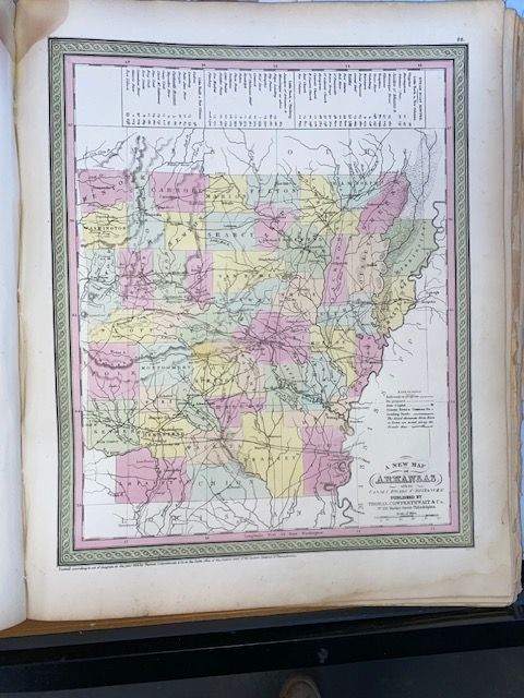
Rare 1854 "A New Map of Arkansas"
$100
Price incl. GST (15%) $13.04
In stock: 1 available
Product details
"A New Map of Arkansas with its Canals, Roads, and Distances" is a highly sought-after antique commercial map originally prepared by the legendary American geographer Samuel Augustus Mitchell.
While the plate was engraved earlier, the rare 1854 edition represents a fascinating historical snapshot published in Philadelphia by the firm Thomas Cowperthwait & Co. as Plate 26 of Mitchell's New Universal Atlas.
Core Specifications & Visual Style
- Dimensions: Approximately 15 x 12 inches (38 x 30.5 cm).
- Aesthetic: It features Mitchell's signature mid-19th-century style, boasting a distinctive green interlocking scrollwork border and vibrant pastel hand-colouring to delineate county lines.
- Cartographic Relief: Topography and changing elevations are elegantly illustrated using fine hachures.
Key Historical Details Featured
- Steamboat Routes Table: Running prominently along the top border is a highly detailed statistical table indexing the major steamboat routes of the era, logging precise travel distances from the state capital, Little Rock, down to major ports along the Mississippi and Arkansas Rivers.
- Transportation & Expansion: The map captures a transitional pre-Civil War Arkansas, documenting the early web of overland stage roads, proposed canals, and the very beginnings of early railroad lines just as the state began its push toward rapid internal development.
- Geopolitical Boundaries: The state is shown bordered by Missouri, Louisiana, Mississippi, Tennessee, and the crucial frontier boundary of the "Indian Territory" to the west (modern-day Oklahoma). It explicitly highlights the shifting county lines of the 1850s before many larger counties were subdivided
Rare 1854 "A New Map of Arkansas"
Display prices in:NZD