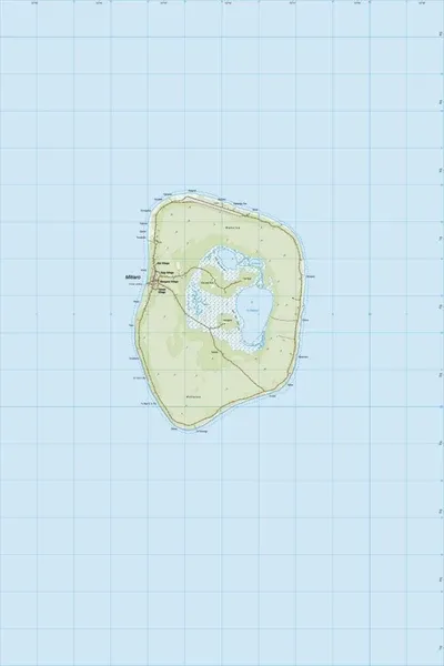
PI18 Mitiaro
$8
Price incl. GST (15%) $1.04
Size
Please choose
In stock: 1 available
Product details
"PI18 Mitiaro" refers to the official topographic map of Mitiaro Island, a remote coral atoll in the Southern Cook Islands. [
Published by Land Information New Zealand (LINZ) under the "PITopo25" map series, the designation breaks down as follows:
- PI: Pacific Islands series
- 18: Sheet number 18 (with neighboring sheet PI17 covering Mangaia and PI19 covering Mauke)
- Scale: 1:25,000 (where 1 cm on the map equals 250 meters on the ground)
About the Map Sheet
The PI18 map was updated to Edition 1.00 by LINZ using satellite imagery and field updates. For hikers, cartographers, and visitors, the map details critical updates to the island's infrastructure, such as:
- The elevation contours mapped at 20-meter intervals.
- The upgrading of traditional inland tracks to metal (gravel) roads.
- Precise locations of local churches, villages, and community buildings
PI18 Mitiaro
Display prices in:NZD