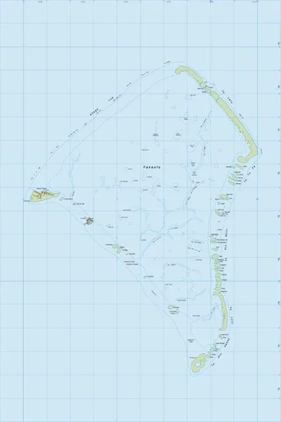
PI03 Fakaofo
$8
Price incl. GST (15%) $1.04
Size
Please choose
In stock: 1 available
Product details
PI03 Fakaofo is the official sheet designation for the topographic map of Fakaofo Atoll, published at a 1:25,000 scale by Land Information New Zealand (LINZ). It is part of the New Zealand Offshore Island and Pacific Region map series, which provides precise geographic records for territories under New Zealand's administrative oversight.
About the Map Sheet
- Publisher: Land Information New Zealand (Toitū Te Whenua).
- Map Number & Scale: PI03 at a 1:25,000 scale.
- Map Details: Features precise contour lines, coral reef structures, coastal features, vegetation, and local village building footprints.
Geographic Profile of Fakaofo
The land area covered by the PI03 map represents the southernmost coral atoll of Tokelau, a non-self-governing territory of New Zealand:
- Structure: Comprises over 60 tiny, low-lying islets (motu) that span roughly 3 to 4 square kilometers of actual land area, surrounding a massive closed central lagoon of about 45 to 50 square kilometers.
- Settlements: Unlike the single-island setups of its neighbors Nukunonu (PI02) and Atafu (PI01), the population of Fakaofo is uniquely divided between two distinct islets on the western rim: Fale (the tightly clustered, historic main settlement) and Fenua Fala (established in 1960 to alleviate overcrowding, housing the local school, hospital, and telecom infrastructure).
PI03 Fakaofo
Display prices in:NZD