PI02 Nukunonu
$8
Price incl. GST (15%) $1.04
Size
Please choose
In stock: 1 available
Product details
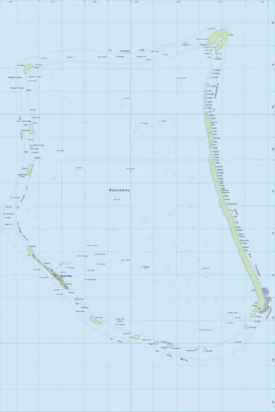
PI02 is the official topographic map sheet designation for Nukunonu Atoll, the largest atoll in Tokelau.
The map series is produced by Land Information New Zealand (LINZ) as part of its charting and mapping assistance for Pacific island territories.
Map Details
Scale: 1:25,000
Formats Available: Available in digital GeoTIFF and physical print formats.
Coverage: Includes all 30 of the low-lying coral islets that encircle Nukunonu’s large central lagoon.
Adjacent Sheets: It sits within a three-part series for Tokelau, bookended by sheet PI01 (Atafu Atoll) to the north and sheet PI03 (Fakaofo Atoll) to the south
PI02 Nukunonu
Display prices in:NZD