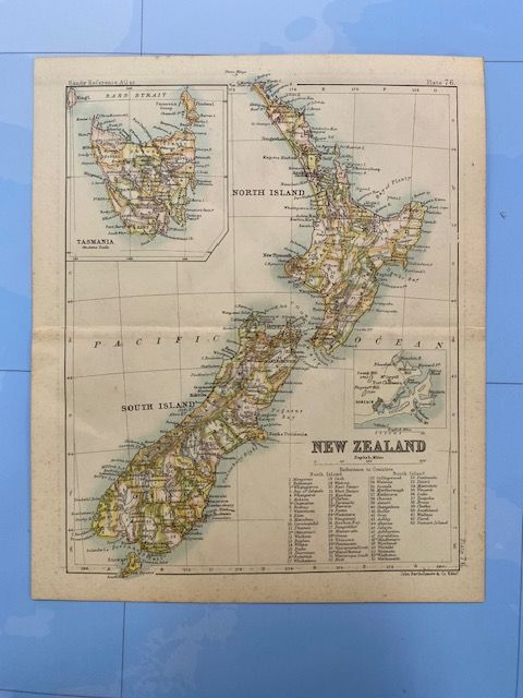
Original -Map of New Zealand and of Tasmania 1893
$80
Price incl. GST (15%) $10.43
In stock: 1 available
Product Details
"Map of New Zealand and of Tasmania"
This celebrated 19th-century antique lithograph atlas plate, produced by John Bartholomew & Co., holds historical significance as a remarkable cartographic piece.
Historical Background
First introduced in 1871 as part of A Descriptive Hand Atlas of the World by A. Fullarton & Co., this specific cartographic layout was continuously updated and published by the Edinburgh-based John Bartholomew & Co. throughout the late Victorian era. Notable editions include those from 1888, 1893, 1898, and into the early 1900s.
Plate 76
Plate 76 in John Bartholomew’s Handy Reference Atlas of the World is the designated plate number for the standalone map of New Zealand and Tasmania.
- This specific plate appeared across multiple late-Victorian and early-Edwardian editions of the highly popular, miniature pocket atlas.
- It was most notably featured in the 1888 first edition, the 1893 update, and subsequent printings.
Plate Characteristics
Dimensions
- As a compact "elbow companion" atlas, the plate measures approximately 21 cm × 18 cm (8.25" × 7.12").
Layout
- The map prominently displays the North and South Islands of New Zealand as the main focus.
- A small, detailed inset map of Tasmania is also included.
- The border features alphabetical coordinate grids linked directly to the atlas's global index.
Printing Technique
- Produced using chromolithography, a color printing process that replaced manual hand-tinting.
- This technique provided clean, bright, and distinct pastel colors for the provincial and county borders.
Publishers
- Drafted and engraved by John Bartholomew & Co. in Edinburgh.
- Published and distributed internationally through London houses like John Walker & Co. or E.P. Dutton in New York.
This antique map is a timeless piece of cartographic history, showcasing the artistry and precision of 19th-century mapmaking.
Save this product for later
Original -Map of New Zealand and of Tasmania 1893
Display prices in:NZD
