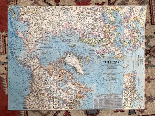
Original 1965 Top Of The World Map
$35
Price incl. GST (15%) $4.57
In stock: 1 available
Product details
The "Top of the World" map was published by the National Geographic Society in November 1965 as Atlas Plate 3.
Compiled by the Cartographic Division for The National Geographic Magazine, this Cold War-era map centers on the Arctic Ocean and the polar region. This perspective uniquely highlighted the geographical proximity between the United States and the USSR during a period of high geopolitical tension.
Map Details & Specifications
- Title: Top of the World: Atlas Plate 3
- Publication Date: November 1965 (Vol. 128, No. 5)
- Format: Fold-out paper magazine insert/supplement
- Dimensions: Approximately 64 x 48 cm
- Cartography: Features detailed Arctic bathymetry, shipping lanes, and sub-insets illustrating the relationship and distances between North America, Europe, and the Far East.
Condition - Map has visible fold lines showing some minor wear and tear, has been laminated to preserve condition.
Original 1965 Top Of The World Map
Display prices in:NZD