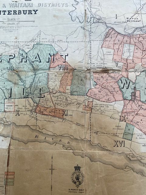
Original 1899 Waikakahi Estate Map – Elephant Hill & Waitaki (Linen Backed)”
$150
Price incl. GST (15%) $19.57
In stock: 1 available
Product Details
Brand: Historic Maps
The 1899 Plan of the Waikakahi Estate, Elephant Hill & Waitaki Districts is a historic cadastral map published by the Department of Lands and Survey to accompany the government's subdivision and ballot of Allan McLean’s massive 47,320-acre Waikakahi pastoral and agricultural property in South Canterbury.
Map Details & Background
-
Publisher:
Government Printer (Wellington), under the direction of the Hon. John McKenzie, Minister of Lands. -
Original Scale:
Approximately 1:63,360 (one inch to one mile). -
Physical Format:
Issued as a folded color map (approx. 37 x 55 cm), typically tipped into official settlement promotional pamphlets titled The Waikakahi Settlement, Canterbury, New Zealand. -
Content:
Displays farm section boundaries, pastoral runs, and the layout of the newly designated township of Morven.
An authentic 1899 lithograph map from the historic McLean estate subdivision. Linen-backed for field use. Shows cracking, staining, fold wear, and tearing consistent with its 127-year age. Unframed. Perfect local history piece for a South Canterbury homestead.
Save this product for later
Original 1899 Waikakahi Estate Map – Elephant Hill & Waitaki (Linen Backed)”
Display prices in:NZD
