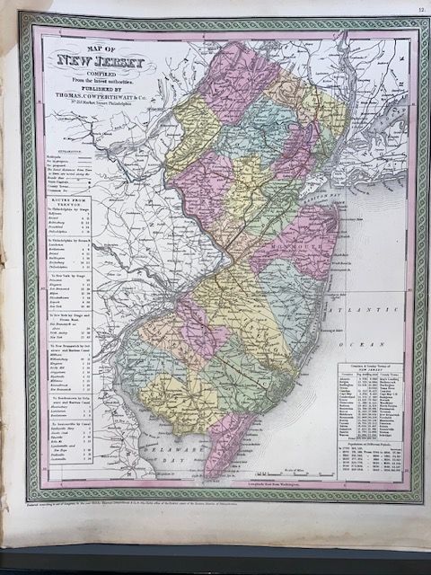
Original 1854 Mitchell Map of New Jersey
$200
Price incl. GST (15%) $26.09
In stock: 1 available
Product details
The 1854 Mitchell Map of New Jersey is a highly detailed, hand-coloured antique map created by the prominent American cartographer Samuel Augustus Mitchell and published by the Philadelphia firm Thomas, Cowperthwait & Co.
Key Characteristics & Details
- Cartographer & Publisher: Prepared by S. A. Mitchell for inclusion as a plate in the 1854 edition of his acclaimed New Universal Atlas.
- Coverage: The map extends vertically northward from Delaware Bay and Cape May, showcasing the entire state of New Jersey alongside adjacent portions of New York, Pennsylvania, and Delaware.
- Details Featured: It provides extensive mid-19th-century geographical details, including county lines, major townships, roads, railways, and local topography.
- Aesthetic Style: It features Mitchell’s signature vibrant, distinctive multi-colour pastel wash and a decorative floral border characteristic of the atlas's publications from this precise period.
- Dimensions 33cm x 42cm
- Excellent condition
Original 1854 Mitchell Map of New Jersey
Display prices in:NZD