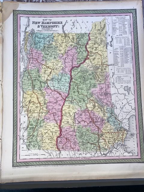
Original 1854 Mitchell Map of New Hampshire & Vermont
$200
Price incl. GST (15%) $26.09
rare
In stock: 1 available
Product details
The original 1854 Mitchell Map of New Hampshire and Vermont was published as plate number 7 in the 1854 edition of Mitchell’s New General Atlas (also associated with the continuation of Mitchell’s Universal Atlas) by the Philadelphia publisher Thomas Cowperthwait & Co
Key Features of the 1854 Map
- Cartographer & Publisher: Created by American geographer Samuel Augustus Mitchell and issued by Thomas Cowperthwait & Co.
- Geographical Scope: Centered on the Connecticut River (which forms the physical boundary between Vermont and New Hampshire), covering both states alongside portions of neighboring Massachusetts, Maine, New York, and Canada.
- Visual Style: Features hand-colored pastel tints by county/political boundary, distinctive green or decorative borders, and elevation rendered via hachures (short lines used to shade and show relief/slopes).
- In-Depth Data: Includes four inset statistical tables in the upper-right quadrant detailing the counties, towns, and historical populations of both New Hampshire and Vermont.
- Dimensions: Approximatly 35cm x 43cm
- Very good condition, blank on reverse
Original 1854 Mitchell Map of New Hampshire & Vermont
Display prices in:NZD