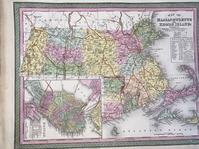
Original 1854 Mitchell Map of Massachusetts and Rhode Island
$350
Price incl. GST (15%) $45.65
Original Rare
In stock: 1 available
Product details
The original 1854 Mitchell Map of Massachusetts and Rhode Island is a highly detailed, hand-coloured antique map created by the renowned American cartographer Samuel Augustus Mitchell. Originally engraved in 1850, it was officially published as Plate 8 in the 1854 edition of Mitchell's New General Atlas by the Philadelphia-based firm Thomas Cowperthwait & Co.
Key Characteristics & Features
-
Geographical Coverage: It encompasses the complete states of Massachusetts and Rhode Island, detailing terrain and geography spanning eastward from Berkshire to Nantucket, Buzzard's Bay, Martha's Vineyard, and Cape Cod.
-
Historical Boston Inset: A distinct, localized city plan of downtown Boston resides in the lower-left quadrant. Crucially, it preserves a visual snapshot of the city before the historic Back Bay landfill project permanently altered Boston's waterfront topography.
-
Signature Aesthetic: The map is celebrated for Mitchell's iconic mid-19th-century design choices, including a vibrant green border layout, vivid pastel colour-coding for political boundaries, and topographical mountain elevations rendered via delicate hachure engraving lines.
-
Technical Specs: The map sheet measures approximately 12.5 x 15 inches (31.75 x 38.10 cm) and utilizes a scale of 1:825,000
-
Very good condition - blank on reverse
Original 1854 Mitchell Map of Massachusetts and Rhode Island
Display prices in:NZD