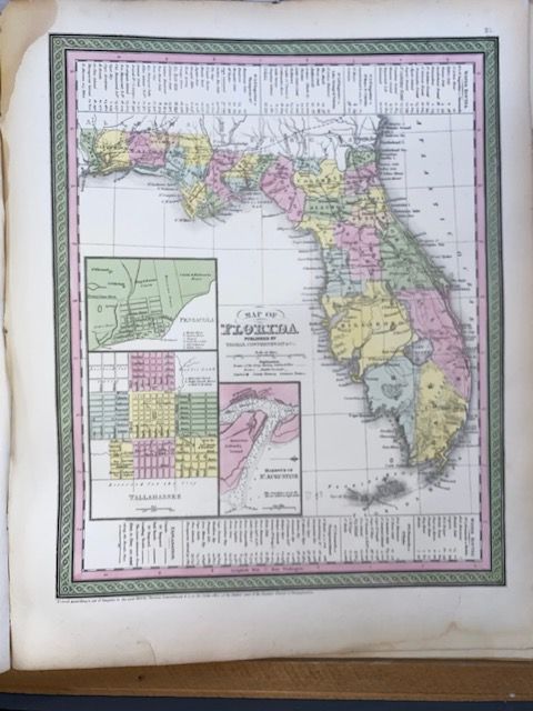
Original 1854 Mitchell Map of Florida
$86.96
In stock: 1 available
Product details
The 1854 Map of Florida by Samuel Augustus Mitchell is a highly regarded historical artifact published by Thomas, Cowperthwait & Co. It captures a crucial pre-Civil War era in Florida's history, depicting the state's early geography and infrastructure in extraordinary detail.
Key Features of the 1854 Map
-
Vivid Aesthetics: The map is celebrated for Mitchell’s distinctive cartographic style, featuring hand-colored pastels, intricate hachure lines to show elevation, and an elegant green border.
-
Historical Detail: It maps out early counties, towns, roads, swamps, and military forts established during the Seminole Wars. At the time, South Florida was largely undeveloped; only seven massive southern counties existed (including Dade, Monroe, and Orange), and the area near modern-day Miami featured little more than Fort Dallas and Key Biscayne.
-
Water Route Tables: Reflecting the importance of maritime travel at the time, tables detailing water routes and distances are engraved at the top and bottom of the map. [1]
-
Detailed Insets: The lower-left quadrant includes three specific regional close-ups:
- A town plan of Pensacola (including surrounding plantations)
- A town plan of Tallahassee (the state capital)
- A nautical chart of the Harbor of St. Augustine featuring depth soundings
Dimensions 31cm x 37 cm
In excelent condition and perfect for framing
Original 1854 Mitchell Map of Florida
Display prices in:NZD