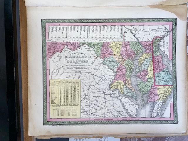
Original 1854 Mitchell A New Map of Maryland and Delaware
$200
Price incl. GST (15%) $26.09
In stock: 1 available
Product details
Capture a Piece of Pre-Civil War American History
Add a stunning centerpiece to your collection or home decor with this genuine 1854 original hand-coloured map of Maryland and Delaware. Published by the renowned Thomas, Cowperthwait & Co. in Philadelphia for Mitchell’s New General Atlas, this authentic 172-year-old cartographic masterpiece captures the Mid-Atlantic region on the eve of the American Civil War.
✨ Key Features & Visual Appeal
- Iconic Mitchell Border: Framed by S.A. Mitchell’s signature, intricately detailed interlocking vine-and-leaf border.
- Vibrant Hand-Colouring: Features beautiful, original hand-tinted pastel hues distinguishing county lines, exceptionally preserved over nearly two centuries.
- Fascinating Historic Insets: Includes highly detailed, localized inset maps of the District of Columbia and the bustling city lines of Baltimore.
- Era-Specific Infrastructure: A time capsule of pre-war America, meticulously documenting early railroads, operational canals, historic stagecoach roads, and coastal marshlands.
📋 Condition Report & Specifications
- Year of Publication: 1854 (Authentic mid-19th-century printing; not a modern reproduction or digital print).
- Dimensions: Approximately
33cm x 42cmsheet size. - Condition: Excellent antique condition.
- Margins: Full, untrimmed original margins, making it perfectly suited for archival matting and framing.
Original 1854 Mitchell A New Map of Maryland and Delaware
Display prices in:NZD