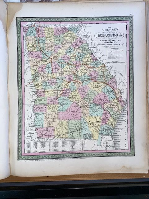
Original 1854 Mitchell " A New Map of Georgia"
$150
Price incl. GST (15%) $19.57
In stock: 1 available
Product details
The original 1854 Mitchell "A New Map of Georgia with its Roads & Distances" is a highly regarded historical artifact of American cartography. Prepared by Samuel Augustus Mitchell and published by the prominent Philadelphia firm Thomas Cowperthwait & Co., this map was included as plate number 20 in the landmark 1854 edition of Mitchell’s New General Atlas.
Key Characteristics & Visual Features
-
Theme & Focus: It highlights the rapidly growing infrastructure of the antebellum American South, intentionally centering attention on the complex network of roads and railroads crisscrossing Georgia.
-
Layout Details: The lower-left quadrant features a dedicated tabular index detailing steamboat routes and exact mileages. Elevation across the state is rendered using classical cartographic hachures.
-
Distinctive Aesthetic: It is easily identifiable by Mitchell's signature vivid pastel color-coding for county lines, completed with a meticulous green-colored decorative border work.
-
Dimensions: The original print measures roughly 14.5 x 12 inches (36.83 x 30.48 cm).
Original 1854 Mitchell " A New Map of Georgia"
Display prices in:NZD