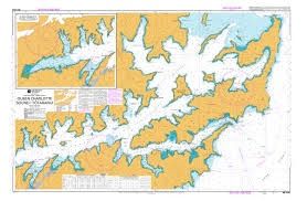
NZ6153 Queen Charlotte Sound / Tōtaranui
$21.74
Sold out
Sold out
Product details
NZ6153 is the official Land Information New Zealand (LINZ) hydrographic paper nautical chart for Queen Charlotte Sound / Tōtaranui.
Chart Overview
- Scale: 1:36,000
- Region: Cook Strait Zone, North Coast of the South Island
- Coverage: Detailed marine mapping of Queen Charlotte Sound, including depths, hazards, coastal landmarks, and navigation aids. It also includes an inset map continuing westward at the same scale
NZ6153 Queen Charlotte Sound / Tōtaranui
Display prices in:NZD