Garmin Australia and New Zealand Coastal Charts BlueChart g3 | HXPC024R | microSD™/SD™
$299
Price incl. GST (15%) $39
In stock: 1 available
Product Details
Brand: Garmin
Unparalleled Coastal Chart Coverage
- Exceptional Coverage: Provides exceptional coverage, clarity, and detail with coastal charts that feature integrated Garmin and Navionics® data.
- Auto Guidance Technology¹: Calculates a route using your desired depth and overhead clearance, providing a suggested path to follow.
- Depth Range Shading: Includes depth range shading for up to 10 depth ranges, allowing you to view your target depth at a glance.
- Detailed Contours: Up to 1’ contours deliver a more accurate depiction of the bottom structure, improving fishing charts and navigation in swamps, canals, and marinas.
Experience unparalleled coverage and brilliant detail when you’re on the water with charts featuring integrated Navionics® data, Auto Guidance technology¹, and more.
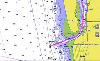
Auto Guidance Technology
Whether you are fishing or cruising, select a spot and get a route showing you the general path and nearby obstructions at a safe depth¹.
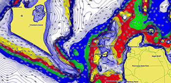
Depth Range Shading
This feature displays high-resolution depth range shading for up to 10 depth ranges, enabling you to easily view your designated target depth.
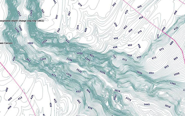
Detailed Contours
BlueChart g3 charts feature 1’ contours that provide a more accurate depiction of bottom structure for improved fishing charts and enhanced detail in swamps, canals, and port plans.
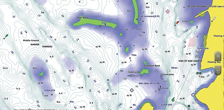
Shallow Water Shading
To aid in navigation, Shallow Water Shading allows map shading at a user-defined depth, giving a clear picture of shallow waters.
¹Auto Guidance is for planning purposes only and does not replace safe navigation practices. Auto Guidance is not included in preloaded BlueChart g3 for ECHOMAP™ Plus series chartplotters.
Save this product for later
Garmin Australia and New Zealand Coastal Charts BlueChart g3 | HXPC024R | microSD™/SD™
Display prices in:NZD