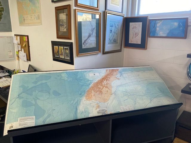
Custom Joined Bathymetry Map of South Island
$100
Price incl. GST (15%) $13.04
In stock: 1 available
Product details
Custom trimed and joined large wall map using the Resolution and Bounty Bathymetry sheets
Map size - 188cm x 68cm - Matte Laminated
The "Resolution and Bounty " bathymetry sheets are a specific coastal/oceanic chart published in 1972 by the New Zealand Oceanographic Institute (NZOI), a division of the former Department of Scientific and Industrial Research (DSIR).
Chart Details
- Title: Resolution [cartographic material] : bathymetry
- Authors/Contributors: Willem J.M. van der Linden, P. Lawrence, and P.H. Brown.
- Publication Date: 1972
- Original Publisher: Department of Scientific and Industrial Research (DSIR) / New Zealand Oceanographic Institute
Map Contents & Purpose
The chart maps the undersea topography (bathymetry) around the Resolution area (referring to the Resolution Ridge / Fiordland region of southwestern New Zealand). It features colored isobaths (depth contours), recorded echo-sounding traverses, and seafloor channels. Like most legacy charts in this series, it is strictly designated for scientific and research purposes and is not to be used for marine navigation
Custom Joined Bathymetry Map of South Island
Display prices in:NZD
