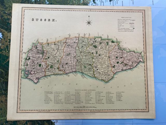
Antique map of Sussex by Henry Teesdale 1829
$150
Price incl. GST (15%) $19.57
In stock: 1 available
Product details
Sussex by Henry Teesdale, 1829
An original hand-coloured 1828–1829 Henry Teesdale map of Sussex features distinct, delicate pastel washes that were individually applied by a colourist in London workshops prior to binding. The presence of original paint on premium J Whatman Turkey Mill 1828 paper makes this map a highly desirable example of Regency-era cartography.
Key Features:
-
Steel Engraved Map with Hand Colouring:
This map showcases the precision and artistry of Regency-era cartography. -
Historical Significance:
Henry Teesdale (1776–1856), a renowned cartographer and map publisher, was elected to the Royal Society in 1832. This map of Sussex was published in the New British Atlas in 1829, highlighting his prominence in the field.
Key Details:
- Page Size: 46cm by 37cm
- Condition:
- Map Area: In excellent condition for its age, with clear engravings.
- Paper: Clear and clean with no damage.
- Watermark:
The watermark "J WHATMAN / TURKEY MILL / 1828" is clearly visible.
This beautifully preserved map is a testament to the craftsmanship of Henry Teesdale and a valuable piece of cartographic history.
Antique map of Sussex by Henry Teesdale 1829
Display prices in:NZD
