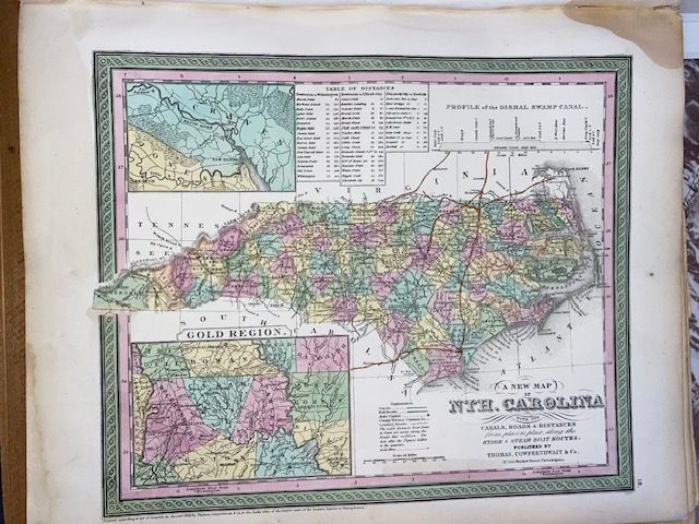
Antique 1854 Mitchell "A New Map of North Carolina"
$300
Price incl. GST (15%) $39.13
In stock: 1 available
Product details
The 1854 edition of Samuel Augustus Mitchell's "A New Map of North Carolina" is an exceptionally important piece of American cartography. Published by the Philadelphia firm Thomas, Cowperthwait & Co., this iconic map captures North Carolina during a fascinating period of technological growth, shifting political borders, and resource exploration.
Key Features of the 1854 Map
-
The Gold Regions: One of the most sought-after aspects of this particular edition is the detailed "Gold Region" inset in the lower-left corner. This highlights the counties active during the North Carolina Gold Rush (which predated the California rush and was highly significant to the US economy).
-
Transportation & Infrastructure: True to Mitchell's focus on practical use, the map details the state's growing networks, including canals, roads, and railways. It explicitly features lists of stagecoach and steamboat routes, including local mileage charts from place to place.
-
Aesthetic Details: Like most mid-19th-century Mitchell maps, it is instantly recognizable by its vibrant hand-coloured county divisions and the distinctive, elaborate floral border block framing the entire page.
Antique 1854 Mitchell "A New Map of North Carolina"
Display prices in:NZD