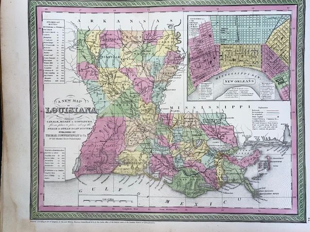
Antique 1854 Mitchell "A New Map of Louisiana"
$200
Price incl. GST (15%) $26.09
In stock: 1 available
Product details
The 1854 edition of Samuel Augustus Mitchell’s "A New Map of Louisiana" is a highly sought-after piece of mid-19th-century American cartography.
Published during a transitional period by Thomas, Cowperthwait & Co. in Philadelphia, this specific map is celebrated for its distinctive pastel hand-colouring, elaborate decorative borders, and rich historical details of the antebellum American South.
Key Features & Cartographic Details
-
New Orleans Inset: The map prominently features a detailed street-level inset of New Orleans in the upper right quadrant, detailing the city's rapidly expanding wards, shipping wharves, and public squares along the Mississippi River.
-
Transportation & Steamboat Routes: Reflecting the economic boom of the era, it meticulously records the state's internal transport networks, including developing railway lines, common roads, and critical steamboat routes complete with travel distances between key ports.
-
Antebellum Geography: The map depicts Louisiana color-coded by its historical counties and parishes. It highlights early towns, swamp topographies, geological features, and extensive river networks that dictated the state's plantation economy.
-
The Intermediary Border: This specific 1854 version sports the signature vine-and-scroll border style typical of Mitchell atlases from the early-to-mid 1850s, right before transitioning to the distinct floral borders used in his 1860s New General Atlas series.
Antique 1854 Mitchell "A New Map of Louisiana"
Display prices in:NZD