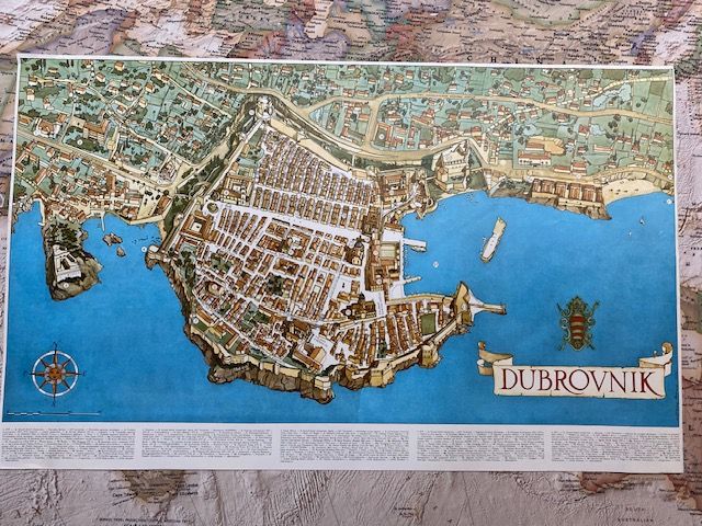
1962 pictorial bird's-eye view map of Dubrovnik.
$150
Price incl. GST (15%) $19.57
In stock: 1 available
Product details
The 1962 Olivera Bravačić Map
This vibrant, highly detailed pictorial map was designed by architect Olivera Bravačić. It was specifically published in 1962 to coincide with the landmark inauguration of the Dubrovnik Airport (Čilipi), a milestone that transformed the historic town into a modern Mediterranean tourist resort.
Key Features of the Map
-
Design & Features:
It features a panoramic, illustrative perspective of the city's unique topography, architecture, and cultural landmarks. -
Multilingual Legend:
The map includes an index/legend written in five languages, marking 27 prominent locations such as hotels, restaurants, villas, and the transport path leading to the new airport. -
Historical Context:
It beautifully captures Dubrovnik's transition period as it evolved from an ancient maritime stronghold into a bustling, globally connected summer destination.
Map size - 66cm x 41 cm
1962 pictorial bird's-eye view map of Dubrovnik.
Display prices in:NZD
