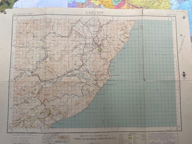
1943 First Edition MAP NZMS Sheet 62 Cheviot
$50
Sold out
Price incl. GST (15%) $6.52
Sold out
Product details
The 1943 First Edition of NZMS 1 (Sheet S62) for Cheviot is a highly sought-after historical topographic map. It covers the Cheviot region in Canterbury, New Zealand, mapped at a scale of 1:63,360 (1 inch to 1 mile).
Key Map Details
-
Series:
NZMS 1 (New Zealand Mapping Service 1), which served as the primary national topographic map system. -
Sheet Number:
S62 (South Island Sheet 62). -
Projection:
SIMG (South Island Main Grid / Yard Grid). -
Significance:
Produced during World War II, these early first-edition maps are prized by collectors and historians for documenting wartime geography, historic property boundaries, infrastructure, and native landscapes before post-war developments.
Later editions of this specific sheet were updated and printed in 1966 and 1974. -
Map Condition:
- Linen-backed, measuring 80cm x 60cm.
- Visible fold lines with some wear.
- Small holes, cracks, and minor tears around the border.
1943 First Edition MAP NZMS Sheet 62 Cheviot
Display prices in:NZD
