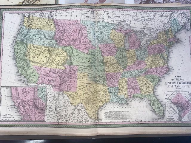
1854 Mitchell Map of the United States (Plates 4-5)
$1,800
Price incl. GST (15%) $234.78
In stock: 1 available
Product Details
Brand: Historic Maps
The 1854 Mitchell Map of the United States (Plates 4-5) is a highly significant, double-page historical map featured in the 1854 edition of Mitchell's New General Atlas. Published by the prominent Philadelphia firm Thomas Cowperthwait & Co., this layout spans two plates, offering a detailed, coast-to-coast view of America during a transformative era of rapid westward expansion.
Condition and Dimensions
- Map is in Very Good Condition: Outer edges of the sheet have some browning and cracks.
- Blank on reverse.
- Double-page map.
- Size: 70 cm x 43 cm.
🌟 Key Historical & Cartographic Features
Westward Migration Routes
The map prominently features crucial transcontinental pathways connecting the East Coast to the newly admitted state of California. Key routes include:
- Oregon Trail
- Fremont's exploratory routes
- Kearney's Route along the Arkansas River
- Great Spanish Trail
Pre-Gadsden Borders
Although published in 1854, the year of the Gadsden Purchase, the map still depicts the Gadsden Purchase territory as part of Mexico. Locations such as Tucson are shown within Mexican boundaries, reflecting the delay in updating commercial plates.
Enormous Western Territories
The map captures a unique snapshot of the American West before modern state lines were drawn:
- Missouri Territory: Spanning from the Rocky Mountains to the Missouri River.
- Utah Territory: Extending from the California border to the Rockies, with the Great Basin labeled as the "Fremont Basin".
- Oregon & Washington Territories: Both stretching far inland to meet the Rocky Mountains.
Vibrant Inset Maps
Set into the corners of the map are distinct illustrations highlighting key areas of 1850s American focus:
- California Gold Region: Including the Sacramento and San Joaquin Valleys.
- National Capital at Washington D.C.
Signature Mitchell Aesthetic
Engraved with exceptional precision, the plates are celebrated for:
- Vivid pastel hand-coloring
- Dark green decorative floral borders
- Detailed hachures to indicate mountain ranges
This map is a remarkable piece of history, reflecting the dynamic changes and aspirations of mid-19th century America.
Save this product for later
1854 Mitchell Map of the United States (Plates 4-5)
Display prices in:NZD
