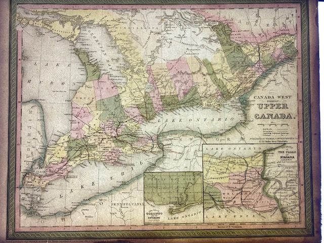
1854 Mitchell Map of Canada West
$173.91
In stock: 1 available
Product details
The 1854 Mitchell Map of Canada West (historically known as Upper Canada, modern-day Ontario) was published as Plate No. 4 in Mitchell’s New General Atlas. This historical map was prepared by Samuel Augustus Mitchell and printed and distributed by the Philadelphia firm Thomas Cowperthwait & Co.
Key Features of the Map
-
Historical Context:
The detailed rendering of Lakes Huron, Erie, and Ontario reflects the geographic focus of the Treaty of Reciprocity (in effect from 1854 to 1866), which established free trade and shared navigation rights between the United States and Canada. -
Cartographic Details:
Features hand-coloured county divisions, major towns, early railway systems, and canals. Topography and elevation are rendered using traditional hachure lines. -
Design:
Framed by an ornate, decorative border typical of Mitchell's mid-19th-century atlas plates. -
Copyright Notice:
The plate bears the legal imprint: "Entered according to act of Congress in the year 1850 by Thomas Cowperthwait & Co. in the Clerk's office of the Eastern District of Pennsylvania."
Condition and Dimensions
- Condition: The map is in very good condition. However, the outer edges of the sheet show some browning and cracks.
- Reverse Side: Blank.
- Size: 35cm x 43cm.
1854 Mitchell Map of Canada West
Display prices in:NZD
