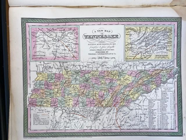
1854 Mitchell "A New Map of Tennessee"
$250
Price incl. GST (15%) $32.61
In stock: 1 available
Product details
The 1854 edition of "A New Map of Tennessee" is a highly detailed, hand-coloured antique map created by the prominent American cartographer Samuel Augustus Mitchell. Published during a critical transitional era in American mapmaking, this specific 1854 variant was issued through the Philadelphia firm Thomas, Cowperthwait and Company, who had acquired Mitchell's plates to continue his famous Universal Atlas series. [
Key Cartographic Features
-
Transportation Focus: True to its full historical title, the map meticulously documents the state's infrastructure, explicitly charting roads, stagecoach lines, and steamboat routes. It features precise distance tables indicating the mileage from place to place along these primary transit pathways.
-
Urban Insets: To provide closer detail on expanding mid-19th-century urban hubs, the map features two prominent inset illustrations: the Environs of Nashville in the upper left corner and the Environs of Knoxville in the upper right corner.
-
Visual Styling: The map is instantly recognizable by its vibrant, distinctive fretwork or grapevine style border, which was a signature aesthetic trait of the Thomas, Cowperthwait and Company Mitchell editions. Counties are separated using unique pastel, hand-tinted watercolours, and local terrain is depicted using traditional hachure lines to represent mountains and topography.
-
Prime Meridians: In keeping with standard American mapmaking of the pre-Civil War era, longitude is oriented from both Greenwich and Washington, D.C., with the Washington meridian line visibly running through the top centre of the map.
Historical Context
This map captures Tennessee right at a major economic turning point. While earlier editions focused heavily on rivers and dirt stage roads, the mid-1850s marked the rapid introduction of commercial railroads across the state. Consequently, the 1854 edition serves as an important historical snapshot documenting the exact moment Tennessee's geography transitioned from water-and-trail reliance to an industrialized, rail-connected economy
1854 Mitchell "A New Map of Tennessee"
Display prices in:NZD