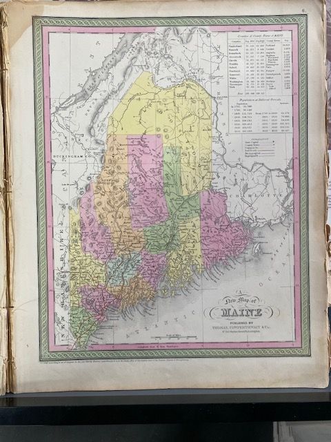
1854 Mitchell "A New Map of Maine"
$200
Price incl. GST (15%) $26.09
In stock: 1 available
Product details
Condition and Dimensions
- Map is in Very good condition: Outer edges of the sheet have some browning and cracks.
- Blank on reverse.
- Size: 35cm x 43cm.
Historical Context & Features
The "New" Title
The word "New" in the title directly references the resolution of the long-standing, heavily disputed northern boundary between the United States and Canada.
Border Disputes
The map historically illustrates multiple border proposals, including:
- The post-Revolutionary War line of 1783.
- The boundary imagined by the King of the Netherlands acting as an arbiter.
- The final 1842 Webster-Ashburton Treaty line, which ceded slightly more territory to Canada.
Cartographic Details
- Engraved and hand-coloured by county in Mitchell's signature style, featuring vivid pastel tones.
- Displays early railroad networks, townships, and navigable waterways.
- Includes two statistical tables at the top listing county populations over time.
The 1854 State
The 1854 publication represents State 21 of the plate, featuring updated and corrected mapping for specific local regions, such as Old Town in Penobscot County.
Prepared by Samuel Augustus Mitchell and published by the Philadelphia firm Thomas, Cowperthwait & Co. as plate no. 6 in the 1854 edition of Mitchell's Universal Atlas (frequently referenced in historical catalogs alongside his later New General Atlas series).
1854 Mitchell "A New Map of Maine"
Display prices in:NZD
