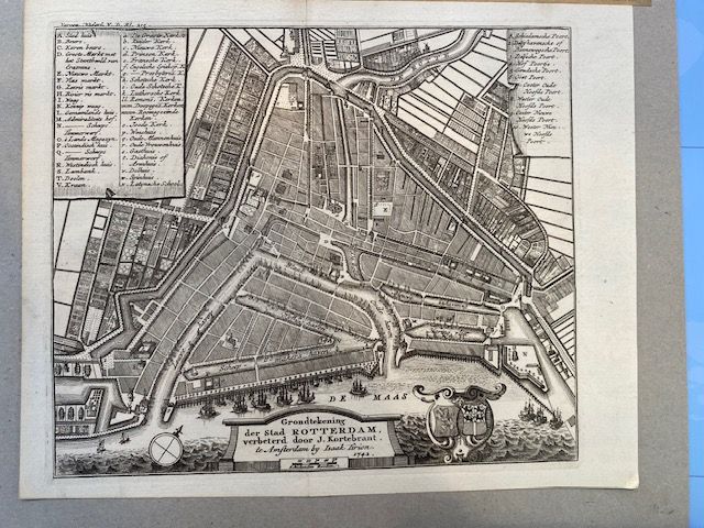
1742 Map - Grondtekening der Stad ROTTERDAM, verbeterd door J. Kortebrant
$300
Price incl. GST (15%) $39.13
In stock: 1 available
Product details
The "Grondtekening der Stad Rotterdam" is an antique copperplate city map of Rotterdam, published in 1742 by Amsterdam publisher Isaak Tirion and improved by cartographer J. Kortebrant.
Key Features:
- Publisher: Isaak Tirion (Amsterdam, 1742)
- Dimensions: Approximately 17 cm high by 20 cm wide
- Design Elements:
- Legends in the upper left and right corners
- A scale bar at the bottom
- A compass rose on the left
- Historic coats of arms of Holland and Rotterdam on the right
This beautifully detailed map is a fascinating glimpse into the past, showcasing the city of Rotterdam as it was in the mid-18th century.
In excellent condition, no foxing or damage to the paper
1742 Map - Grondtekening der Stad ROTTERDAM, verbeterd door J. Kortebrant
Display prices in:NZD
